Walking Postmans Track, Sisters Beach

Photograph of coastal cliffs.

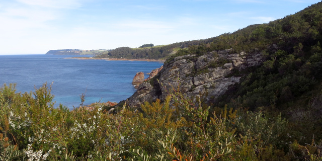
Postmans Track is a walking track along the north coast of Tasmania, Australia. In the early days of the coastal towns of Burnie and Stanley, this track was the shortest land route between the two. It was only suitable for people on foot or on horseback.

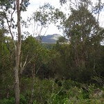
The “Postmans Track” seen here was a short segment in the middle of that original route, passing along cliffs at the eastern edge of Rocky Cape National Park.

Getting there

Postmans Track lies within part of the Rocky Cape National Park, so visitors will need a current National Parks Pass.

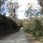
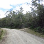
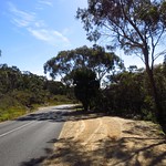
The route to both ends of the track began by driving along the Bass Highway, turning north onto Port Road, then following Sisters Beach Road after Port Road diverted to Boat Harbour. All of these roads were sealed.

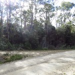
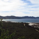
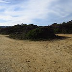
The car park for the southern end of the track was on Sisters Beach Road itself. The car park for the northern end of the track was on Sisters Beach. The road to this car park was unsealed, with large ruts that would be inconvenient if filled with water. Drivers wishing to avoid this could park on Honeysuckle Avenue and walk an additional 1.6 kilometres along Sisters Beach.

Continue reading “Walking Postmans Track, Sisters Beach”

Why we couldn’t walk to the Anchor Stampers on Blue Tier

Photograph of dam with hole due to flood damage.

Update – 21st December 2015

Read the comments on this post for details on a new track to the Anchor Stampers site.

Original Introduction

The Anchor Stampers is a piece of old tin mining equipment once used at the Anchor Tin Mine on the side of Blue Tier, Tasmania, Australia. A 20 minute walking track used to visit the site, but in April 2011 floods destroyed a dam that the track crossed. The photographs in this post show the damage state of the track in May 2013. As of April 2015 the track remained closed, with repairs under discussion.

Getting there

The Anchor Stampers site was on the west side of Anchor Road. This road was unsealed for its entire length, and became progressively narrower and rougher as it continued north. The Anchor Stampers track was near the north end. Parking for the Anchor Stampers was on the side of Anchor Road and easy to miss.

Continue reading “Why we couldn’t walk to the Anchor Stampers on Blue Tier”

Walking to Halls Falls, Tasmania

Photograph of short waterfall in bright sunlight.

Halls Falls lie on the Groom River, near Pyengana, Tasmania, Australia. A short walking track leads to the falls, with branches leading to a few other features along the Groom River and in the nearby forest.

Getting there

Unless you live in the town of Lottah (and, if you do, you don’t need directions to Halls Falls), the best route to Halls Falls is along the Tasman Highway. Drive to the junction with Anchor Road, and turn north there. The car park is on the east side of Anchor Road – on the right, if you are driving north.

Continue reading “Walking to Halls Falls, Tasmania”

Walking up Ben Nevis, Tasmania

Photograph of jagged mountain from below

Ben Nevis is a mountain in Tasmania, Australia, north of the higher and larger Ben Lomond. A rough walking track leads up the mountain.

The Ben Nevis in Tasmania should not be confused with the other mountains named Ben Nevis in Victoria, New Zealand and the United States. All are named after the Ben Nevis in Scotland, the highest mountain in the British Isles.

The Tasmanian Ben Nevis, at 1,368 metres above sea level, is slightly higher than its Scottish namesake (1,344 metres), but shorter than its New Zealand sibling (1,619 metres).

Getting there

Ben Nevis was not easy to drive to, despite being only 42 kilometres east of Launceston. The walking track began off Telopea Road, which ran north-south. From the south, Telopea Road turned off Upper Blessington Road. To the north, it led to Ben Ridge Road and Diddleum Road. All of these roads were unsealed, although still wide and solid enough for two-wheel-drive vehicles. Both routes were about 1.5 hours from Launceston, and correspondingly longer from anywhere farther south or west.

The walk described here started from Telopea Road. The first kilometre of the track was along Schulhofs Road, which four-wheel-drive vehicles could travel with care.

Continue reading “Walking up Ben Nevis, Tasmania”