Detention Falls form on the Detention River, near Wynyard, Tasmania, Australia. A walking track leads to two views of the falls.
Older books that mention this walk may refer to a lookout platform. Parks & Wildlife engineers declared the lookout unsafe in 2008, and later dismantled it. A Severe Hazard Area sign near the start of the walk advised against proceeding on the track at all. As the sign said, continue on the walk at your own risk and taking your own responsibility.
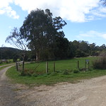
This walk also passes through farm gates and paddocks. Take care around the electric fences and take no action to make landowners regret having a walking track through their property.
Getting there
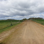
From the Bass Highway, the best route to Detention Falls was to turn south onto Myalla Road. This reached an intersection with Hawley’s Road. Hawley’s Road was unsealed for its two kilometre length, which ended in patch of gravel for parking cars and a gate labelled “Falls Track”. There were also two private farm driveways, both labelled to make it clear that they were not the way to the falls.
Track


The first part of the track passed through four farm gates. The second was part of an electric fence. Always assume that electric fences are live. Close all farm gates behind you.
Track right to side of falls


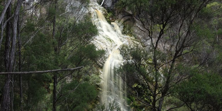
The track to the right from the junction descended gently, even as it curved around the steep slope above the Detention River. It was marked by occasional pieces of yellow and black tape. This tape had also been spread between trees at the end of the track to keep walkers away from the cliffs. Detention Falls themselves were impressive, even while standing well within the tape.
Track left to top of falls


The track to the top of the falls was much steeper than the side track. It ended on the edge of more cliffs. There was no warning tape at all, so it was up to walkers to judge how much risk to accept there.
Plants


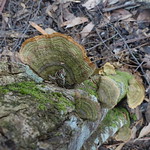
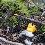


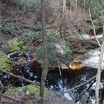
Rainforest myrtles and treeferns grew at the start of the Detention Falls Conservation Area. As the track approached the falls, the environment became drier and the rainforest gave way to dry eucalypt forest. Observant walkers noted a few greenhood orchids flowering.
Animals

Apart from the farm livestock, the only creature seen on this walk was a Sugden’s Flatworm (Fletchamia sugdeni).
Video
This video follows the Detention River downstream, first from the view over the top of the falls, then from the side.
Facilities
| Latest visit | 5th October 2018 |
|---|---|
| Road | Unsealed for the 2 kilometre length of Hawley’s Road |
| Parking | Small, unsealed |
| Shelter | None |
| Toilets | None (nearest toilets are far away at Boat Harbour, in Wynyard and on the Bass Highway) |
Opinions
Ambler
Walked 2.1 kilometres in 1 hour 32 minutes. Was puzzled by some of the gates until walkers who had spent more time on farms demonstrated how to open them. Went first to the view of the side of the falls, then to the top of the falls. The track was easy except for the slope to the top of the falls.
Walking Stick
The track down to the side view of the falls was a delight. It was gently contoured and easy walking with just occasional small well constructed single steps as needed. I did not attempt walk down to the top of the falls as it was way too steep for me. The paddock section required most care due to uneven footprints left by cattle.
Should I visit?
If you are in the Wynyard area and only have time to visit one waterfall, go to Dip Falls. They are easier to get to, safer, and more impressive when seen from the lookout.
If you have already seen the more accessible sights in the vicinity of Wynyard and are happy taking responsibility for yourself on the cliffs, consider walking to Detention Falls.