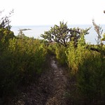
Postmans Track is a walking track along the north coast of Tasmania, Australia. In the early days of the coastal towns of Burnie and Stanley, this track was the shortest land route between the two. It was only suitable for people on foot or on horseback.
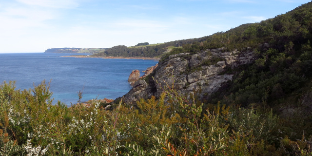
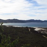
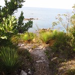
The “Postmans Track” seen here was a short segment in the middle of that original route, passing along cliffs at the eastern edge of Rocky Cape National Park.
Getting there

Postmans Track lies within part of the Rocky Cape National Park, so visitors will need a current National Parks Pass.
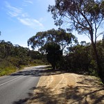
The route to both ends of the track began by driving along the Bass Highway, turning north onto Port Road, then following Sisters Beach Road after Port Road diverted to Boat Harbour. All of these roads were sealed.
The car park for the southern end of the track was on Sisters Beach Road itself. The car park for the northern end of the track was on Sisters Beach. The road to this car park was unsealed, with large ruts that would be inconvenient if filled with water. Drivers wishing to avoid this could park on Honeysuckle Avenue and walk an additional 1.6 kilometres along Sisters Beach.
Track
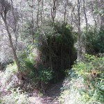
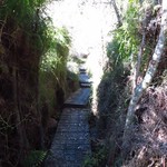
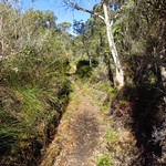
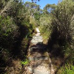


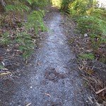
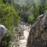
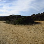
The track was in good condition, and almost all of it was easy to walk. The slope at the north end was an exception, with narrow gaps between boulders and a steep flight of steps.
Plants
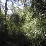
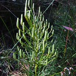
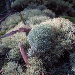
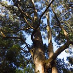
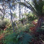
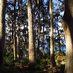
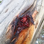
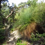
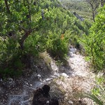
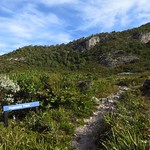
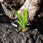
Postmans Track passed through several distinct ecosystems in the short distance between Sisters Beach Road, the ridge, and the descent to Sisters Beach. Plants grew in many varieties and sizes, from small lichen and clubmoss to mighty eucalypts.
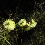
Banksia serrata
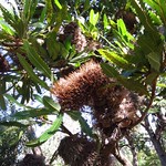


Banksia serrata trees were a special feature of Postmans Track. These are common on the Australian mainland, but only grow near Sisters Beach in Tasmania. Along Postmans Track, they only grew along the edge of the cliff. Elsewhere in Tasmania, the only Banksia is the Banksia marginata.
A sign on Honeysuckle Avenue provided more details about these trees.
Flowers
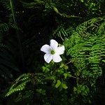
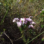
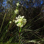

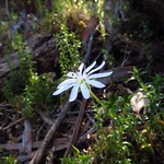
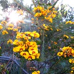
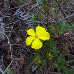


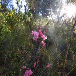
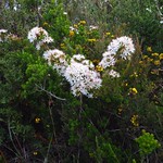
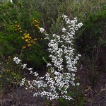
Wildflowers were abundant and varied during our visit in November 2014 (late spring).
Facilities
| Latest visit | 23rd November 2014 |
|---|---|
| Road | Sealed to the southern car park on Sisters Beach Road, unsealed and rough for 1.6 kilometres to the northern car park on Sisters Beach |
| Parking | Medium |
| Shelter | No |
| Toilets | No (go to Sisters Beach) |
Opinions
Walking Stick
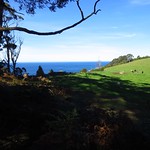
As the designated driver, only attempted the walk up from the northern end. The rough steps were difficult and daunting but the view was excellent even for the little bit covered. Might have been better off walking from the southern end and returning without attempting the steep part.
Ambler
Walked 2.3 kilometres in 1:27. Completed the track one way, from south to north. No complaints about the track. Admired the wildflowers at both ends, and the Banksia serrata. Found one leech.
Racewalker
The track was in good condition and easy to walk, with a variety of bush and scenery along the way. However, the end near the beach had a steep descent with steps, so this was best walked one way towards the beach.
When you get there the rocks at sea level are interesting to clamber around on before you leave.
Should I visit?
This is a good coastal walk, if you are happy with the steps. While many other such walks follow the coastline, Postmans Track crosses a ridge, showing significant changes in vegetation with even small changes in distance from the sea.
If this walk alone does not justify the driving time, plan to see some of the other sights in Rocky Cape National Park. Do Postmans Track at midday or in the afternoon; the trees provide more shade than is found elsewhere in the park.
If you are travelling as a group, arrange to have one person drive to the other end while the rest of the party walks. Start from Sisters Beach Road and your overall journey will be downhill.
References
Parks & Wildlife Service Tasmania – Rocky Cape National Park
Parks & Wildlife Service Tasmania – Visiting National Parks – Rocky Cape National Park (PDF)