Walking to the Pelverata Falls Lookout

Photograph of long brown cliff with waterfall flowing down part of it.

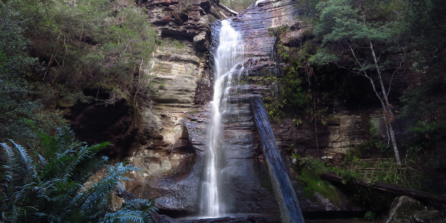
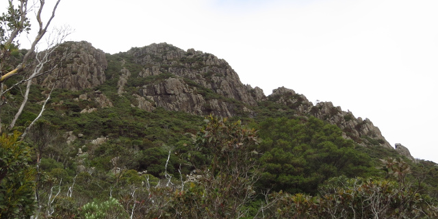
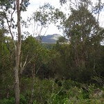
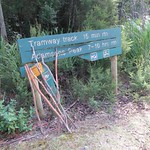
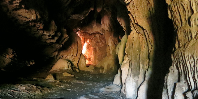
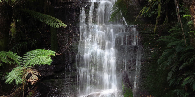
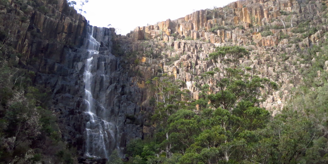
Pelverata Falls form where Pelverata Creek flows west off Snug Tiers on the Huon Peninsula, Tasmania, Australia. The walking track described here leads from Crosswells Road to a lookout below the falls.

Getting there

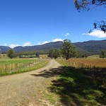
Two road routes led to the start of the walking track. Both were slow driving due to the many bends.

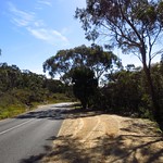
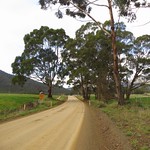
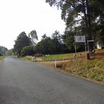
  1. South from Sandfly on Pelverata Road. Drive through Kaoota and Pelverata, then turn left onto Crosswells Road. This half of Pelverata Road was narrow, but was sealed, unlike the other half.
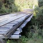
  2. East from Woodstock on Pelverata Road. Drive through Upper Woodstock and across several bridges, then turn right onto Crosswells Road. This half of Pelverata Road was unsealed, but was wider than the other half.

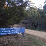
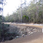
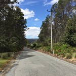
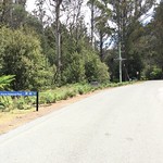
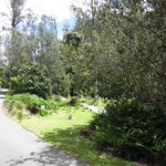
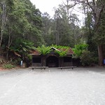
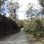
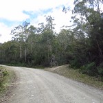
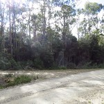
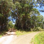
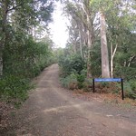
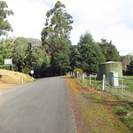
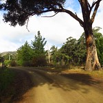
Crosswells Road was also unsealed but only a kilometre long, ending in a car park at the start of the Pelverata Falls Track.

Continue reading “Walking to the Pelverata Falls Lookout”

Walking to Snug Falls

Photograph of waterfall pouring down layered cliff.

Snug falls form where the Snug River flows off Snug Tier, near the town of Snug on the Huon Peninsula, Tasmania, Australia. A short walk leads to the base of the falls.

Getting there

First we drove to the town of Snug, on the eastern side of the Huon Peninsula. Roads on the peninsula have more hills and bends than maps may suggest, so allow plenty of time for this part. From, Snug, Snug Tiers Road led west off the Channel Highway. This soon changed from sealed to unsealed, and split in two, with Snug Tiers Road continuing on the right and Snug Falls Road on the left. We took the left turn onto Snug Falls Road and followed it to the clearly signed car park.

Continue reading “Walking to Snug Falls”

Walking the Fern Glade Track, Marakoopa Cave

Photograph of creek flowing under ferns and over mossy stones.

The Fern Glade Track is a short walk through rainforest near Mole Creek, Tasmania, Australia. It follows Marakoopa Creek to the mouth of Marakoopa Cave.

The Fern Glade at Marakoopa Cave should not be confused with the Fern Glade Great Short Walk along the Emu River in Burnie, the Fern Glade at Fern Tree on Mount Wellington or the Ferndene fern glade in the Dial Range, Penguin.

Getting there

The Fern Glade Track lies within the Mole Creek Karst National Park, so visitors will need a current National Parks Pass or to buy a ticket for the Marakoopa Cave tour.

To reach the start of the walk, we drove along Liena Road, then turned south onto Mayberry Road and followed it to the Marakoopa Cave ticket office. A car park here gave access to the north end of the Fern Glade Track. Another 500 metres beyond that was the car park for Marakoopa Cave itself, and the south end of the track. All roads and car parks were sealed.

Continue reading “Walking the Fern Glade Track, Marakoopa Cave”

Walking Postmans Track, Sisters Beach

Photograph of coastal cliffs.

Postmans Track is a walking track along the north coast of Tasmania, Australia. In the early days of the coastal towns of Burnie and Stanley, this track was the shortest land route between the two. It was only suitable for people on foot or on horseback.

The “Postmans Track” seen here was a short segment in the middle of that original route, passing along cliffs at the eastern edge of Rocky Cape National Park.

Getting there

Postmans Track lies within part of the Rocky Cape National Park, so visitors will need a current National Parks Pass.

The route to both ends of the track began by driving along the Bass Highway, turning north onto Port Road, then following Sisters Beach Road after Port Road diverted to Boat Harbour. All of these roads were sealed.

The car park for the southern end of the track was on Sisters Beach Road itself. The car park for the northern end of the track was on Sisters Beach. The road to this car park was unsealed, with large ruts that would be inconvenient if filled with water. Drivers wishing to avoid this could park on Honeysuckle Avenue and walk an additional 1.6 kilometres along Sisters Beach.

Continue reading “Walking Postmans Track, Sisters Beach”

Why we couldn’t walk to the Anchor Stampers on Blue Tier

Photograph of dam with hole due to flood damage.

Update – 21st December 2015

Read the comments on this post for details on a new track to the Anchor Stampers site.

Original Introduction

The Anchor Stampers is a piece of old tin mining equipment once used at the Anchor Tin Mine on the side of Blue Tier, Tasmania, Australia. A 20 minute walking track used to visit the site, but in April 2011 floods destroyed a dam that the track crossed. The photographs in this post show the damage state of the track in May 2013. As of April 2015 the track remained closed, with repairs under discussion.

Getting there

The Anchor Stampers site was on the west side of Anchor Road. This road was unsealed for its entire length, and became progressively narrower and rougher as it continued north. The Anchor Stampers track was near the north end. Parking for the Anchor Stampers was on the side of Anchor Road and easy to miss.

Continue reading “Why we couldn’t walk to the Anchor Stampers on Blue Tier”

Walking up Ben Nevis, Tasmania

Photograph of jagged mountain from below

Ben Nevis is a mountain in Tasmania, Australia, north of the higher and larger Ben Lomond. A rough walking track leads up the mountain.

The Ben Nevis in Tasmania should not be confused with the other mountains named Ben Nevis in Victoria, New Zealand and the United States. All are named after the Ben Nevis in Scotland, the highest mountain in the British Isles.

The Tasmanian Ben Nevis, at 1,368 metres above sea level, is slightly higher than its Scottish namesake (1,344 metres), but shorter than its New Zealand sibling (1,619 metres).

Getting there

Ben Nevis was not easy to drive to, despite being only 42 kilometres east of Launceston. The walking track began off Telopea Road, which ran north-south. From the south, Telopea Road turned off Upper Blessington Road. To the north, it led to Ben Ridge Road and Diddleum Road. All of these roads were unsealed, although still wide and solid enough for two-wheel-drive vehicles. Both routes were about 1.5 hours from Launceston, and correspondingly longer from anywhere farther south or west.

The walk described here started from Telopea Road. The first kilometre of the track was along Schulhofs Road, which four-wheel-drive vehicles could travel with care.

Continue reading “Walking up Ben Nevis, Tasmania”

Walking to Duckhole Lake

Photograph of small lake surrounded by trees, with reflections.

Duckhole Lake fills a sinkhole near Hastings, Tasmania, Australia. The track to the lake is one of Tasmania’s 60 Great Short Walks.

Getting there

Duckhole Lake is over an hour south of Hobart, and a correspondingly longer drive from anywhere farther north. We stopped at the Hastings Caves Visitor Centre to enquire about the state of the track, then drove north. This was a scenic route, but the southern parts were very narrow, although still suitable for two-wheel-drive cars. The car park was a flat patch of ground next to Creekton Road, just east of a bridge over the Creekton Rivulet.

Continue reading “Walking to Duckhole Lake”

Walking the Adamsons Tramway Track

Photograph of rainforest with long fallen mossy tree trunks.

The Adamsons Tramway Track is a short walk near Hastings, Tasmania, Australia. It overlaps with the much longer Adamsons Peak Track. The tramway portion passes the remains of various old forestry constructions.

Getting there

This track, like most in Tasmania’s far south, was not easy to reach. It began on the Peak Rivulet Road, west of Dover. We began even further south, at Hastings Caves, which meant a long drive north on unsealed forestry roads. The narrowest of these was Creekton Road where it turned north off Hastings Caves Road. As the roads continued north, they became wider and smoother.

The “car park” was a small flat patch at the side of Peak Rivulet Road, next to the sign shown above.

Continue reading “Walking the Adamsons Tramway Track”

Walking in Honeycomb Cave, Mole Creek

The karst landscape of Tasmania’s Mole Creek area is famed for its caves. One of the most accessible is Honeycomb Cave.

Caves are not safe places, and the open nature of Honeycomb Cave can be deceptive.  In June 2015 a visitor to Honeycomb Cave suffered a serious fall.  Watch the ground and do not step anywhere you cannot see clearly.  Do not go out of sight of daylight if you are not a trained and equipped caver.

Getting there

Continue reading “Walking in Honeycomb Cave, Mole Creek”

Walking to Westmorland Falls

Photograph of waterfall between tree ferns.

Westmorland Falls flow off the Great Western Tiers, south of Mole Creek, Tasmania, Australia. The falls are short but picturesque and surrounded by rainforest.

Parts of the walking track to the falls were destroyed by floods in January 2011. Replacement work in 2013 included a new bridge and lookout platform. The bridge survived further floods in 2016 but the lookout platform did not. A replacement platform was built further downstream.

These photographs show the state of the track as it was in January 2015. As of January 2017, the repaired track was about 1.8 kilometres long (3.6 kilometres return).

Getting there

Westmorland Falls lie within part of the Mole Creek Karst National Park, so visitors will need a current National Parks Pass.

The simplest way to navigate to the falls was to drive to Mole Creek, then turn south onto Caveside Road (sealed). We turned west onto Wet Cave Road (unsealed), south at Honeycomb Cave, and then it was a short drive uphill to the Westmorland Falls car park.

If you are approaching from Launceston and are familiar with the area, turning onto Caveside Road at Chudleigh may be more scenic.

Continue reading “Walking to Westmorland Falls”